

EuroVelo 10 Baltic Sea Cycle Route

Curonian Spit & Gulf of Gdansk
Contains the tracks of the whole stage, including well developed sections but also parts of the route under development or at the planning stage.
Contains only parts of the stage which are either developed, developed with signs or certified – i.e. sections that are ready to cycle.
Your contribution helps towards keeping these official GPX tracks up-to-date and freely available to download.
License & Disclaimer

These EuroVelo GPX tracks are made available under the Open Database License. While ECF and National EuroVelo Coordination Centers and Coordinators (NECCs) make every effort to ensure the tracks and their levels of development are both current and accurate, errors or outdated information can occur. The user is fully responsible for his or her own safety when making use of the tracks and for following national traffic rules and signing.

Please download and read the complete How to use gpx tracks and License and disclaimer documents before using the tracks.

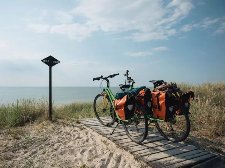
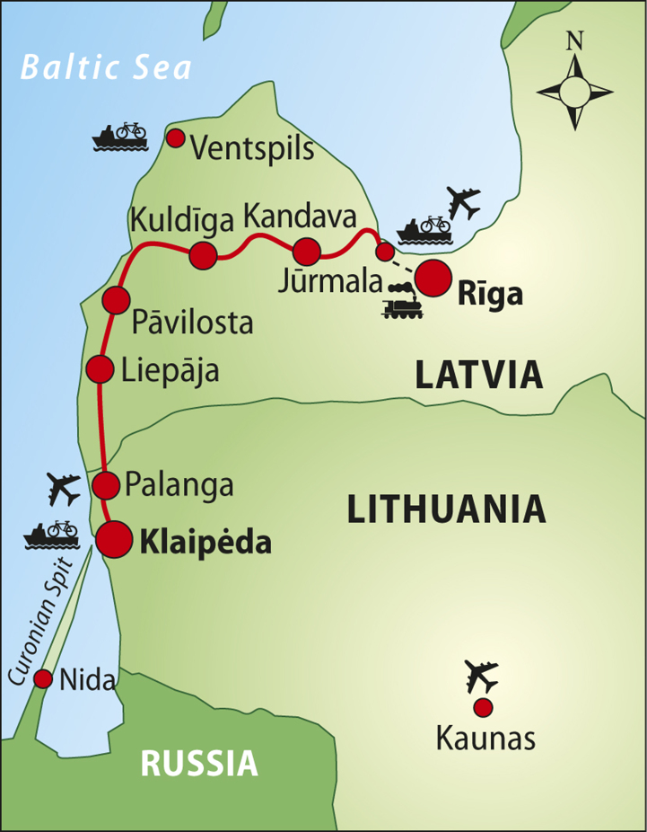
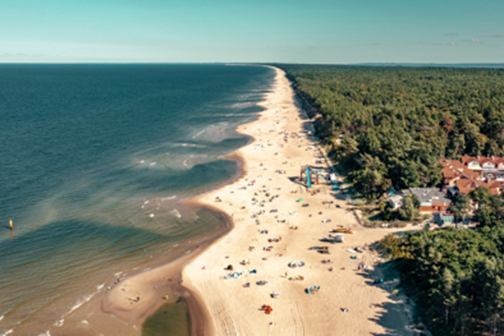
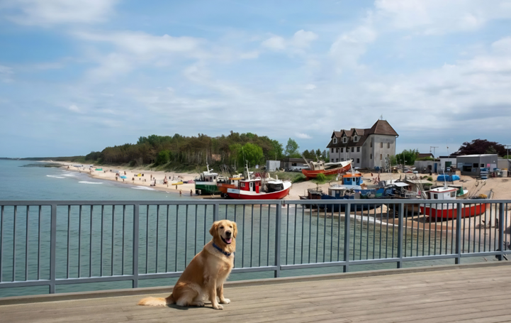
In this stage, EuroVelo 10 - Baltic Sea Cycle Route follows the amazing Curonian Spit – a UNESCO World Heritage Site - and crosses the Kaliningrad Oblast (a Russian exclave). It then crosses the Warimsko-Mazurskie and Pomorskie regions of Poland, where it connects with the GreenVelo route – Poland’s longest cycle route. Warmia and Mazury provide cycling enthusiasts with perfect conditions to practice their favourite form of recreation: forest vistas, dirt paths winding through lakes. EuroVelo 10 leads you through this region until Elblag where you enter the Pomorskie region. The stage ends in Gdańsk, the bustling port city of freedom and Solidarity. The road to Gdańsk leads through Żuławy and Mierzeja Wiślana, a region with special cultural and landscape values, where Malbork is the most powerful medieval castle in Europe - a UNESCO monument.

Due to border crossing and travel restrictions in place, we discourage cyclists from entering Russia at the moment. Thanks to close cooperation with our partners, we are able to suggest a reliable alternative, avoiding high traffic, from Neringa in Lithuania to Braniewo in Poland (527 km). You can download the GPX tracks here or directly visualise them here for Lithuania and here for Poland. Please note that this route is not part of the official EuroVelo 10 itinerary but ensures continuity for now.

Etappes
Landen

Legend

Development status
  • Certified These sections were awarded the official EuroVelo Certification label, ensuring high-quality cycling conditions.They were surveyed in the field by EuroVelo Route Inspectors to respect minimum requirements for motorised traffic levels, surface quality, EuroVelo signage, and access to services as defined by the European Certification Standard (ECS) methodology. EuroVelo Certified routes are the best options for beginners!
  • Developed + Signed These sections offer generally good cycling conditions, with limited motorised traffic, rideable surfaces, and EuroVelo signs along the route. Developed routes with signs are suitable for most cyclists. However, short stretches with lower-quality conditions may occur, and it is recommended to bring a map or navigation app as signs can have defects.
  • Developed + Not Signed These sections offer generally good cycling conditions, with limited motorised traffic and rideable surfaces, but without EuroVelo signs. Developed routes without signs are suitable for most cyclists. However, short stretches with lower-quality conditions may occur, and it is warmly recommended to bring a map or navigation app.
  • Partially Developed + Signed Cycling is possible here, but conditions vary. Some stretches may have high motorised traffic or poor surfaces, even though EuroVelo signs are in place. Partially developed routes with signs are suitable for experienced cyclists only, and it is recommended to bring a map or navigation app and check national/regional websites for more information. ECF and National EuroVelo Coordination Centres are working on improvements.
  • Partially Developed + Not Signed Cycling is possible here, but conditions vary. Some stretches may have high motorised traffic or poor surfaces, and EuroVelo signs are not in place. Partially developed routes without signs are suitable for experienced cyclists only, and it is warmly recommended to bring a map or navigation app and check national/regional websites for more information. ECF and National EuroVelo Coordination Centres are working on improvements.
  • Undeveloped / Unknown These sections do not meet minimum requirements for motorised traffic levels or surface quality – or their conditions are currently unknown. They may include dangerous stretches. Cyclists choosing to cycle there should use a map or navigation app and check national/regional websites for more information. It is recommended to use public transport to skip these areas where possible.
  • Public transport link These sections include continuity across seas or rivers and undeveloped parts of the network that can be skipped with a reliable public transport connection allowing bicycle transport.

Markers

  • Natuurlijk Erfgoed
  • UNESCO-werelderfgoed
  • Cultureel Erfgoed
  • Culinaire Hoogstandjes
  • Maritime Heritage / The Rhine / The Meuse
  • Other Point of Interest
  • Service
  • Bus station
  • Train station
  • Mobility info center

National & Regional Information

Velopiter

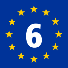
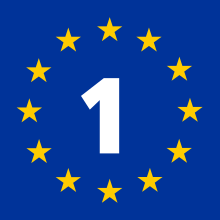
The R1 route is a trans-European cycling path, passing through France, Germany, Poland, the Baltic States.

Website bezoeken

KoenigBicycle

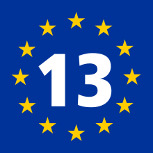
This website of a Kaliningrad cycling club also contains information on routes in the region, including EV10 and EV13. The website is only available in Russian.

Website bezoeken

Russian Cycle Touring Club

Information and help for international cyclists in respect of cycle touring in Russia

Website bezoeken

Cycling in Lithuania / Lithuania Travel

Lithuania offers a flat landscape, short distances, compactness, and plentiful opportunities for bike adventure: stop off for a swim, visit a wake park, take a city tour, hop on a boat trip or ferry crossing – the list goes on. Enjoy one of Northern Europe’s undiscovered gems – on two wheels!

+370 619 29 795
Website bezoeken

Pomorskie Region

Website where you can find the most interesting attractions in the Pomeranian Region. Check what to see and discover the regions of Pomerania. Welcome!

Website bezoeken

Warmia & Mazury Region

Information point for the section between Elbląg and the Poland / Russia border on EuroVelo 10 - Baltic Sea Cycle Route and EuroVelo 13 - Iron Curtain Trail in Poland.

Website bezoeken

Marshall’s Office Zachodniopomorskie

Information point for the section Świnoujscie – Ustka of EuroVelo 10 - Baltic Sea Cycle Route and EuroVelo 13 - Iron Curtain Trail in Poland.

Website bezoeken

Gerelateerd nieuws

Kaarten & Gidsen

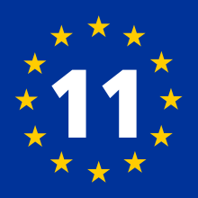
EuroVelo 10, EuroVelo 13: Iron Curtain Trail 1 [Bikeline Esterbauer]

This cycling guide describes EuroVelo routes in Finland from Helsinki, across Russia and Estonia (1,778 km). 10 km to Riga are also described in Latvia. Also available in German. The perfect tool to guide you during your journey preparation and on the road: precise and very informative maps at a scale of 1:120,000 and 1:400,000, elevation and distance profiles, GPS tracks, accommodation and service directory, LiveUpdate, handlebar bag format, and spiral-bound.

EuroVelo 10, EuroVelo 13: Iron Curtain Trail 2 [Bikeline Esterbauer]

This cycling guide describes EuroVelo 10 & EuroVelo 13 in Latvia from Riga, across Lithuania, Russia, and Poland and in Germany up to Lübeck (1,604 km). Half of the route in Latvia is described in the book. The perfect tool to guide you during your journey preparation and on the road: maps at a scale of 1:85,000, elevation and distance profiles, GPS tracks, accommodation and service directory, LiveUpdate, handlebar bag format, and spiral-bound. Also available in German.

EuroVelo 10: Baltic Sea Cycle Route - Part 3 [Bikeline Esterbauer]

This cycling guide describes EuroVelo 10 in Poland from Gdańsk (490 km). The perfect tool before and during your journey: precise and informative maps, 1:75,000 scale, elevation and distance profiles, GPS tracks, accommodation and service directory. Can be used even without any knowledge of German. English translation of the map legend and the user manual of the guide available at esterbauer.com/international.

Services

Cyclist-Friendly Place (Miejsce Przyjazne Rowerzystom)
Polen
EV10 EV13
regional

"Miejsce Przyjazne Rowerzystom" is the recently created (2022) bicycle-friendly system of the Westpomerania Region, Poland, providing services to cyclists, divided into the following categories: accommodation facilities, catering facilities, tourist attractions, tourist information points and other commercial and service facilities.

Website bezoeken